AT309 Lab #6 Field Report
- Leighton Moorlach

- Oct 14, 2021
- 1 min read
Updated: Mar 22, 2022
Overview:
Collecting data using a Mavic 2 Pro at Purdue Wildlife Area to create a mapping model.
Weather Conditions:
Moderate winds, mostly cloudy, 75 degrees Fahrenheit.
Location Conditions:
Ground is wet, lots of vegetation and wildlife, and 13 people total at the location.
Potential Hazards:
Several other drones operating nearby, high tree line surrounding the location, other teams operating on the ground beneath the flight path, vehicles nearby launch location.
Deliverables:
Altitude: 200 ft AGL
Overlap: 80% front and lateral
Camera angle: Nadir (90 degrees)
Single grid
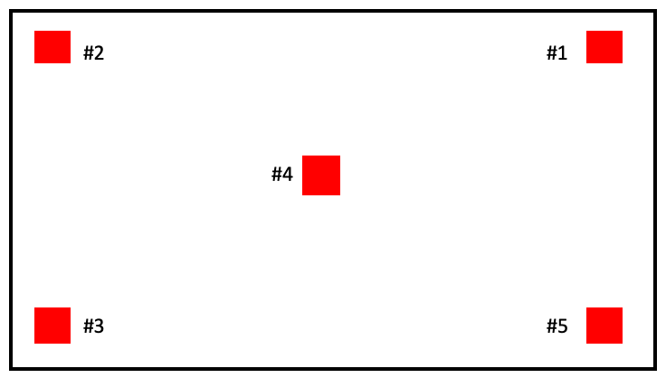
GCP Locations:

Figure 1. Location of the GCP markers.
Flight Data:
Start setup time: 2:30pm
Drone T/O time: 2:42pm
Drone land time: 2:47pm
Mission end time: 2:54pm
Drone operator: Branden Gallimore
Visual Observer: Leighton Moorlach


Comments